OU Research Team Testing Drone Technology to Improve Weather Forecasting
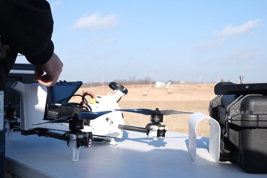
NORMAN, Okla. – This past December, a group of National Weather Center researchers arrived on a McClain County farm. Sending a sleek drone thousands of feet into the air, the team gathered data on the atmospheric boundary layer it traveled through before returning back down to its orange launch pad on the rolling hills.
As the first of several flights that day, the drone launch kicked off a groundbreaking project to improve short-term weather forecasting. The 3D Mesonet system is testing technology to gather spatiotemporal atmospheric data more frequently than ever before in the United States. This approach will allow scientists to better predict short-term, high-impact weather, like thunderstorms, severe winds and winter precipitation.
The National Oceanic and Atmospheric Administration (NOAA)’s National Mesonet Program recently awarded the Oklahoma Climatological Survey (OCS), a University of Oklahoma research unit, with a contract to develop the 3D Mesonet system. OCS director Chris Fiebrich said that his group is utilizing the Oklahoma Mesonet’s statewide network of monitoring stations to launch a fleet of uncrewed aerial systems (UAS) – or drones.
“Over the last 10 years, we’ve worked with scientists at the National Weather Center to make over a thousand flights at our Mesonet stations,” said Fiebrich, who is also a professor in OU’s School of Meteorology. “We’re very proud of that rich history because a lot of other state Mesonets want to get into this UAS arena.”
Those flights have used technology developed by the Cooperative Institute for Severe and High-Impact Weather Research and Operations (CIWRO), which is headquartered at OU and promotes collaboration between the university and NOAA. The latest design, known as the CopterSonde-SWX, is being used in weekly flights at the Kessler Atmospheric and Ecological Field Station (KAEFS) in McClain County.
While the Oklahoma Mesonet’s 10-meter towers collect typical weather station data such as wind speed and relative humidity, drones near these towers can reach further into the atmospheric boundary layer. Using their sensors to gather and send real-time data to researchers, the drones can explore what Fiebrich said are historically unmeasured parts of the atmosphere.
They can also be launched more often than weather balloons, which are only deployed twice a day.
“Perhaps we’re on the morning of a day when we know there’s tornado potential in the afternoon,” Fiebrich said. “Being able to take these UAS flights, perhaps every hour, might help us have a better idea of when those convective storms will initiate and exactly what part of the state they will initiate in.”
He added that the drones could also help predict hazardous winter weather better than existing forecasting models by providing frequent boundary layer readings.
“Living in Oklahoma, we don’t always know whether precipitation is going to be freezing rain, sleet or snow,” Fiebrich said. “We see a lot of potential for these UAS profiles to help us understand how temperatures are evolving at different levels. Small changes in the temperature profile can make the difference between a snow event and a freezing rain event.”
link